Muhl Theron Land Surveyors is a Surveyor establishment in Robertson, Western Cape, South Africa
Muhl & Theron Land Surveyors: Comprehensive Surveying Services in Robertson and the Western Cape
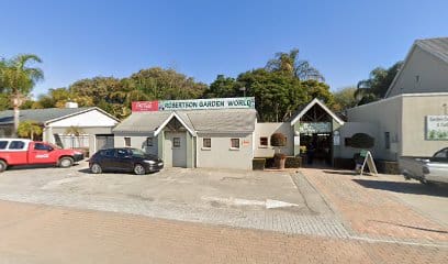
Based in Robertson with an extended reach to towns across the Western Cape, Muhl & Theron Land Surveyors offers a broad suite of professional surveying services aimed at civil engineering, land development and cadastral work. The firm emphasises professionalism, excellence and timeliness, building on decades of combined experience within its team. The practice is led by Arnold Theron, a registered Professional Land Surveyor since 1991, who has delivered surveying solutions in the Langeberg and Breede Valley regions since 2003. The collaborative structure includes Muhl & Theron (RF) Inc, founded in 2016 with Etienne de Villiers, and James Mahon, a Professional Land Surveyor based in Pretoria who works in association with the Robertson team. This blend of local knowledge and broader architectural and surveying networks positions the practice to handle a wide range of projects across its service area.
The firm markets itself as a versatile cadastral and engineering surveying practice, with services spanning engineering and topographical surveys, land development and land information, subdivisions and consolidations, and sectional title surveys. In practice, this means support for both private sector developments and municipal-style land information tasks, with an emphasis on accurate measurement, careful planning and timely delivery. The service descriptions highlight a commitment to delivering results in a busy civil engineering environment, where contour surveys and set-outting of buildings are undertaken with a focus on professionalism, efficiency and client satisfaction at every stage of the project.
Typical job categories suggested by the service areas include engineering and topographical surveys for infrastructure and development projects, land information work to clarify grids and boundaries for planning purposes, subdivisions and consolidations to reorganise plots or properties, and sectional title surveys for multi-unit developments. These categories align with common needs in the Western Cape’s property and development sector, including the management of complex boundary definitions, title and plan updates, and the preparation of site layouts for construction or land-use planning. The presence of an office in Robertson and associated professionals indicates a practical capability to service both local clients and neighbouring towns, such as Montagu, McGregor, Swellendam, Barrydale, Ashton, Bonnievale, Ladismith, Worcester and Rustenburg, reinforcing the firm’s regional footprint.
From a customer experience perspective, the available information suggests a focus on reliability, timely communication and clarity throughout the surveying process. The firm’s stated ethos—Professionalism. Excellence. Timeliness.—frames expectations around deliverables, problem-solving, and the coordination required between surveyors, engineers and developers. The inclusion of a dedicated contact for the Rustenburg office and the Robertson office indicates a structure designed to accommodate client access and project management across multiple locations, which can be beneficial for clients with cross-site or multi-site requirements.
Visitor feedback on the firm’s services is represented by public reviews, including positive multi-star ratings, which signal a generally favourable client perception of the surveying team’s professionalism and performance. While the available snippets do not provide granular detail about individual projects, the presence of positive ratings supports the impression of a dependable practice capable of meeting client expectations in a competitive regional market.
Practical tips for customers planning to engage Muhl & Theron include:
- Clarify project scope early: outline whether engineering, topographical or cadastral work is required to ensure the team can assemble the appropriate survey plan and timelines.
- Prepare boundary and title documents: having existing deeds or previous plans on hand can speed up boundary verification and plan reconciliation.
- Discuss timeframes upfront: given the emphasis on timeliness, aligning on project milestones can help manage expectations and scheduling for site visits or plan submissions.
- Consider regional requirements: the broad service area includes multiple towns in the Western Cape, so confirm accessibility for site-specific visits and any municipal submission processes that may apply.
- Account for site access: ensure permission and access to site areas are arranged in advance to avoid delays on the day of measurement and set-out works.
Service delivery areas include Robertson and the broader Western Cape region, with practical coverage spanning the listed towns in the firm’s portfolio. While specific business hours were not stated on the accessible content, the firm’s regional presence and professional approach imply readiness to engage with clients during standard business days, subject to individual appointments.
Robertson
Western Cape
South Africa
Surveyor Services in Robertson, Western Cape
In Robertson, Western Cape, surveying practitioners provide essential professional services for property owners, developers, builders and local authorities. The work centres on accurately measuring and documenting land, structures and boundaries to support safe development, compliant planning and clear property records. Although the exact scope varies by project, typical surveying engagements share a focus on precision, reliability and clear communication of findings and recommendations.
Land and boundary surveying are among the core offerings in this region. A boundary survey determines the extents of a land parcel as defined by title deeds and cadastral records, often locating fences, walls or other markers in relation to official boundaries. Subdivision of land, consolidation of parcels, or the relocation of boundaries are common drivers for these services, especially in areas with growing demand for housing, agricultural ventures or viticultural developments typical of the Western Cape. Where boundaries are disputed or unclear, surveyors can provide accurate plans and written reports to facilitate resolution.
Topographic and detail surveys form another important category. These surveys capture natural and man-made features across a site, including levels, contours, trees, drainage lines, existing structures and utility corridors. The resulting maps support planning applications, environmental assessments and the design process for new buildings, renovations or infrastructure projects. In Robertson, authorities and developers frequently rely on such data to integrate site realities with engineering design and compliance requirements.
Construction surveying, sometimes called setting out or control surveying, helps ensure structures are positioned and built according to design specifications. This involves establishing reference points, level control and monitoring during excavation, foundation work and structural erection. Regular checks and as-built documentation are typically produced to verify that work remains compliant with plans and regulations.
Engineering and geomatics services may include site measurements for roadworks, irrigation schemes, water supply installations or agricultural infrastructure. Where necessary, surveyors utilise levelling, total stations, digital levels and, in many cases, remote sensing or drone data to gather accurate information quickly and safely. The resulting plans, profiles and data sets support design, quantity take-offs and project management in a practical, recordable format.
Delivery and collaboration are important aspects of the service in Robertson. Clients can expect a clear assessment of scope, estimated timelines and a straightforward quotation outlining deliverables. Typical outputs include survey plans, digital maps or drawings, location coordinates, volumes, elevations and written reports. These documents are prepared to align with standard local practices and are suitable for submission to municipal authorities or landowners as part of consent, approval or title processes.
Practical considerations for engaging a surveyor in Robertson include access to the site, safety considerations, and any regulatory or heritage constraints that may apply to rural or vineyard land. Early coordination with landowners, neighbours and council planning departments helps prevent delays and surprises. Clients should be prepared to provide title deeds, existing plan copies, and any relevant permission letters or encumbrances. Clear communication about intended outcomes—such as a subdivision, a new build, or an irrigation project—helps ensure the survey work aligns with overall project objectives.
In terms of workflow, a typical project begins with an initial site visit or data review, followed by measurement, plan preparation and quality checks. The final phase involves presenting the results in an with accompanying calculations and maps, and, where required, providing copies in both print and digital formats suitable for submission to authorities or inclusion in project documentation. The outcome is a dependable, well-documented basis for decision making and implementation, grounded in accurate measurement and professional interpretation.
- Boundary and cadastral surveying
- Topographic and detail surveys
- Subdivision, consolidation and land development planning
- Construction surveying and setting out
- Engineering and geomatics data for infrastructure or agricultural projects
Sorry, no records were found. Please adjust your search criteria and try again.
Sorry, unable to load the Maps API.